Featured on NASA Landsat Science: GEOG researcher’s work -
“Watching River Islands Grow on the Brahmaputra”
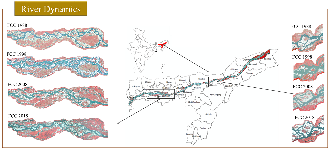
Brahmaputra is the seventh largest river and the second largest carrier of sediment load in the world carrying average annual sediment of 735 million tonnes. The Brahmaputra river of Assam is characterised by its highly braided channel pattern. The pattern has a number of river islands of various sizes and shapes. With yearly occurring floods these islands keep on changing in shape, sizes and its orientation. The high intensity of monsoon rains, easily erodible bank materials and their deposition lead to formation of large number of sandbars locally called Chars. Keeping in view the changes in the river configuration of the Brahmaputra main channel a study has been undertaken to map the changes and present status in order to assess the stability/instability of the chars using satellite remote sensing and also to identify the present chars with settlements. This study has been carried out by our PhD student Meghavi with North Eastern space application Center, NESAC, Shillong , India and it got featured in Landsat Science, here is the link to the article : https://landsat.gsfc.nasa.gov/watching-river-islands-grow-on-the-brahmaputra/.
Findings:
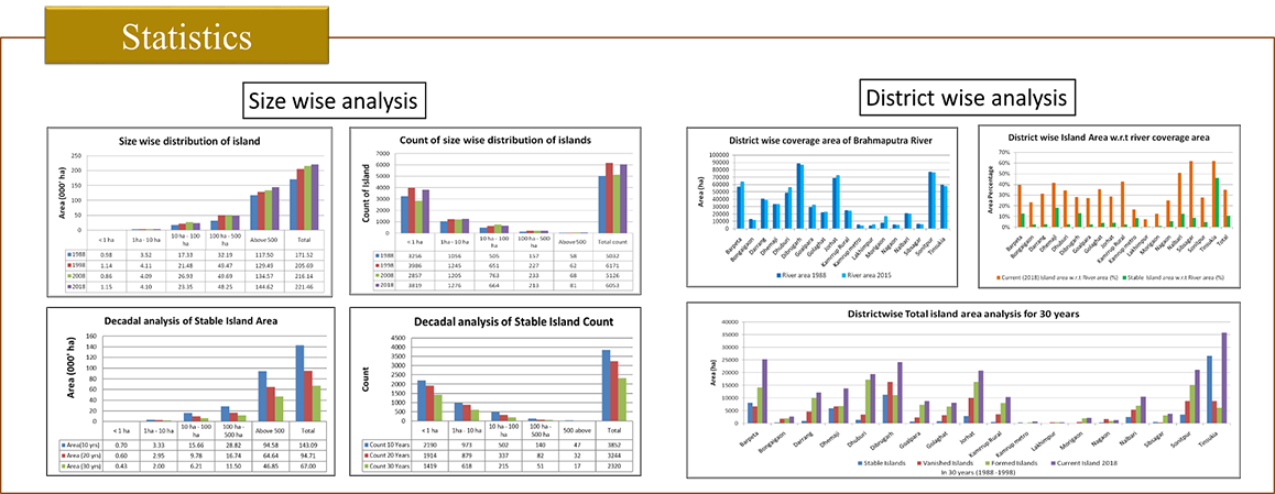
The study shows that the island area is increasing continuously, in past 30 years island area has increased approximately by 50 thousand hectares. These chars are mainly eroded from the upper catchment of the river and deposited in lower Assam. The overall extent of the Brahmaputra river is also increasing at the cost of erosion of land surface along the river banks. The rate of char formation is greater than the rate at which the Brahmaputra river extent is increasing. These chars occupied approximately 33% of the overall area of the river for the 2017-2018 post monsoon season in Assam while in 1988, it was occupying 28% of river extent (after major flood in 1988) . There are 50 islands in range of 100 - 500 hectares which are stable from 3 decades. There are only 17 islands bigger than 500 hectare which are stable and most of them are in upper Assam. The islands in Dhemaji and Dibrugarh districts have shown most unstable behavior over 30 years.
Implications
These findings will help decision makers to better understand the problems of Brahmaputra river bank migration and help understand how to utilize the river islands for various societal applications. The animals in the adjacent national park called Kaziranga National park gets affected by flood every year, in 1988 the flood killed around 1200 animals including rhinoceros, tigers , boars , wild buffaloes and deers. This study will help the forest officials to find out the safer places for migrating the animals. The outcomes of this study will be useful for rehabilitation of char dwellers, as there are many chars where the settlements exists and many chars where there is possibilities for settlements. This study can also be used for expansion of agriculture and horticulture, as these islands are fertile, the chars are already being used for short duration crops but much of the area remains unused. Identifying suitable sites for solar panel installation and wind mills is another major implications of our study.


