Department of Geographical Sciences PhD candidate Aolin Jia, Professor Shunlin Liang and Professor Dongdong Wang developed a Surface Energy Balance (SEB) based method to generate a gap-free hourly land surface temperature (LST) product over the Contiguous United States (CONUS) and Mexico at 2-km resolution. The dataset is recovered from NOAA’s official GOES-16 Advanced Baseline Imager LST from 2017 onward, which is the first gap-free hourly LST product at this region freely available to the public.
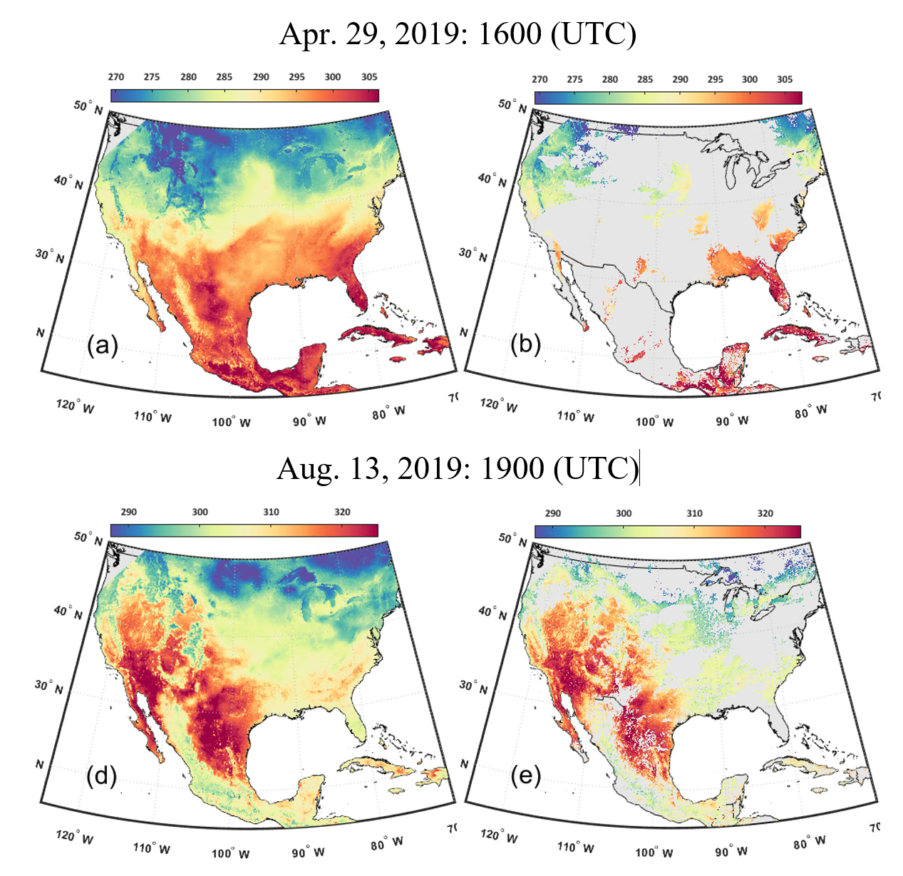
As an essential component in the surface radiation budget, LST is the thermal radiative temperature of the earth’s land surface and an important indicator for monitoring climate warming, permafrost, heat islands, .etc. Moreover, the diurnal temperature cycle (DTC), which characterizes daily temperature dynamics, can be effectively utilized in drought mapping, evapotranspiration estimation, and heatwave detection. DTC can be recorded by geostationary satellites, such as GOES-16. However, given that thermal signals cannot penetrate clouds, massive invalid values are left on the satellite images, seriously restricting its applications.
By combining satellite observations with model data, a SEB-based method has been developed, and hourly LST from ABI has been well recovered. Site validation suggests that the published LST has satisfactory and stable accuracy at both clear-sky and cloudy-sky with higher spatial resolution, significantly better than previous hourly LST data that are only available from reanalysis datasets.
For more information, read the paper published in Remote Sensing of Environment.
The product is freely available here.