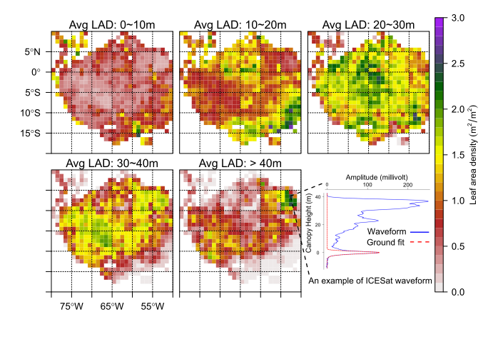
GEOG Assistant Research Professor Dr. Tang and Collaborators Dr. Dubayah and Dr. Armston were awarded a project "Integrating Space-Borne Lidar Observations to Characterize Vegetation Structure Dynamics across Tropical Forests" within NASA's New (Early Career) Investigator Program in Earth Science.
The primary objective of the project is to explore the spatial and temporal dynamics of vertical vegetation structure across tropical forests and investigate major drivers and impacts of these dynamics, primarily using data from NASA's spaceborne lidar fleet: the past ICESat (2003~2009) and two upcoming missions GEDI and ICESat-2 (both scheduled for launch in 2018). This proposal echoes the call from NASA to promote and increase the use of space-based remote sensing to discover and demonstrate ecological and biodiversity hypothesis. Its anticipated results can greatly advance the capacity of NASA's lidar satellites in monitoring 3D structure dynamics of dense tropical forests, as highlighted by National Academies of Sciences, Engineering, and Medicine's latest Decadal Strategy for Earth Observation from Space.


