GEOG Researchers (PI: S.Skakun, Co-I's: B. Franch, J.-C. Roger) along with Co-I J. Hatfield from USDA-ARS and Collaborators from USDA-NASS (D. Johnson), Ukraininan Space Research Institute (N. Kussul), The Buenos Aires Grain Exchange (E. Copati), Argentina InstitutoNacional de Tecnologia Agropecuaria (S. Veron and D. de Abelleyra), Agriculture and Agri-Food Canada (C. Champagne) and South African Agriculture Research Council Institute for Soil, Climate and Water (T. Newby) were awared a grant on "Crop Yield Assessment and Mapping by a Combined Use of Landsat-8, Sentinel-2 and Sentinel-1 Images” within NASA's Land Cover/Land Use Change Multisource land Imaging (MuSLI) program.
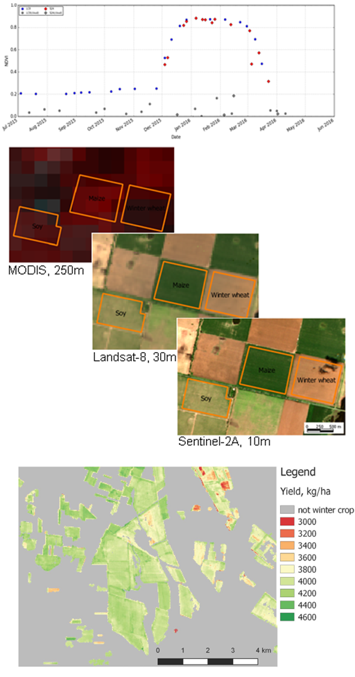
The overall scientific goal of the project is to develop a new algorithm and products for agriculture monitoring, namely crop yield assessment and mapping, by combining moderate spatial resolution images acquired by Landsat-8, Sentinel-2 and Sentinel-1/SAR remote sensing satellites. The project will take advantage of an increased temporal frequency of observations and coverage as well as combination of optical and microwave (SAR) imagery to generate new products that will provide improved spatially explicit crop yield mapping at regional and field scales. The products will be generated for three crop types, namely wheat, corn and soybean, that are within the top 6 major commodities in the world and account for 25% of global crop production. Crop type and crop yield products will be generated for administrative regions (with area ranging from 28,000 km2 to 308,000 km2) for 7 countries (Argentina, Canada, France, South Africa, Tanzania, Ukraine and US). Validation of these products will be performed at field and regional scales for test sites in these regions covering different agriculture practices and a wide range of conditions in terms of field size (0.5 ha to 500 ha) and yields (1.5 t/ha to 10 t/ha).