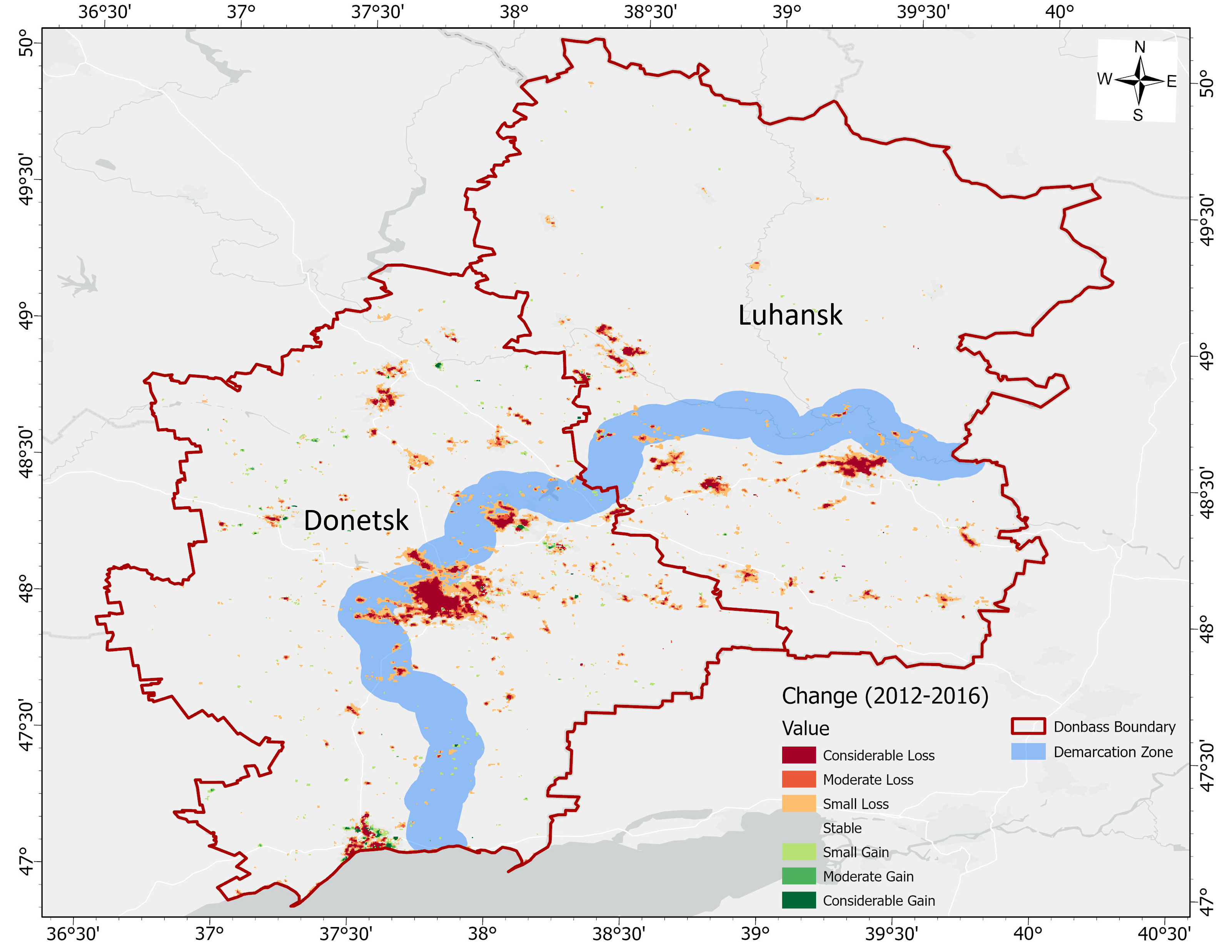
Even before Russian tanks rolled through the Ukrainian Border in the early hours of the recent 2022 invasion, Ukraine had long been facing the environmental ramifications of the earlier conflict starting in 2014. Several researchers in the Department of Geographical Sciences have focused on this region, particularly in regards to the remote sensing of Ukrainian wheat production as well as the broader theater of land cover research. Despite these efforts, it is still unclear how the War in Ukraine has affected the landscape and environment across specific land-use classes. A recent paper published by GEOG Faculty Specialist Jaemin Eun and Assistant Professor Sergii Skakun aims to address these discrepancies.
The study takes a novel approach to Land Cover Land Use Change (LCLUC) research through the use of the VIIRS DNB (Day/Night Band) detectors. These “night-time images” provide valuable insights into the frequency and magnitude of human activities by recreating the evolution of events spurred by the War in Ukraine. By breaking up these activities based on specific land-use classes and decoupling administrative boundaries, the authors established highly sensitive human-environment interactions.
Read the full article here: https://iopscience.iop.org/article/10.1088/1748-9326/ac8b23