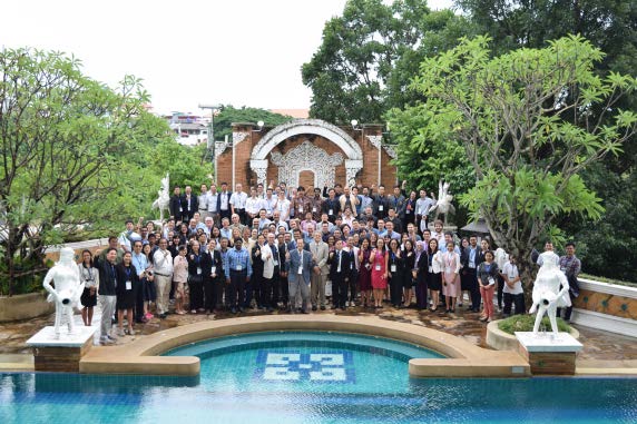
South/Southeast Asian countries have the highest population growth rate worldwide and account for more than 25% ofthe global population. This population growth—together with rapid economic development—is leading to the conversion of forested areas to agriculture and agricultural areas to residential and urban uses, with significant impact on ecosystem services. Increased land cover and landuse changes in the region are impacting forest resources, biodiversity, regional climate, biogeochemical cycles, and water resources. To address these issues in the framework of NASA’s Land Cover/Land Use Change (LCLUC) Program-funded South/Southeast Asia Research Initiative (SARI), an international science meeting was held in Chiang Mai, Thailand, July 17-19, 2017. The National Astronomical Research Institute of Thailand (NARIT), based in Chiang Mai, hosted the meeting. The goal of the meeting was to review the availability, potential, and limitations of different satellite data sources and methodologies for land-use mapping, quantification, monitoring, and environmental impact in South/Southeast Asia. Overview presentations
described research accomplishments and the current state of scientific information on these topics. The meeting included a poster session with 40 presentations. In total, 165 participants from 16 countries from Asia, Europe, and the U.S. attended the meeting. Scientists from other space agencies also attended, including representatives from the Japan Aerospace Exploration Agency (JAXA), the Space Technology Institute (of Vietnam) and Vietnam National Space Center (VNSC), the Geo-Informatics and Space Technology Development Agency (GISTDA) of Thailand, the International Centre for Integrated Mountain Development (ICIMOD) in Nepal, as well as representatives from international programs, including the Global Observation of Forest and Land Cover Dynamics (GOFC–GOLD) and Group on Earth Observations’ (GEO) Global Agricultural Monitoring [GEOGLAM]. After the meeting, 95 early-career scientists from different countries participated in a three-day, hands-on training, focused on the use of remote sensing and geographic information systems (GIS) for LCLUC applications. The local hosts also organized a two-day field visit that gave meeting participants an opportunity to observe local land cover and land use changes in and around Inthanon National Park in Chiang Mai—see Field Visit to Inthanon National Park on page 41.
The meeting had the following objectives:
- to review regional and national science priorities, relating to LCLUC in the region;
- to review the causes and impacts of LCLUC specific to agriculture, forests, urban, and coastal ecosystems;
- to review greenhouse gases (GHGs) and aerosol sources, sinks, and impacts; and
- to strengthen the SARI activities.
Toward those ends, the agenda was organized around the following four themes:
- agricultural LCLUC;
- emission inventories and land-atmosphere interactions;
- urban LCLUC; and
- LCLUC and forestry.


