Workshop to Boost Cropland Mapping Accuracy and Consistency
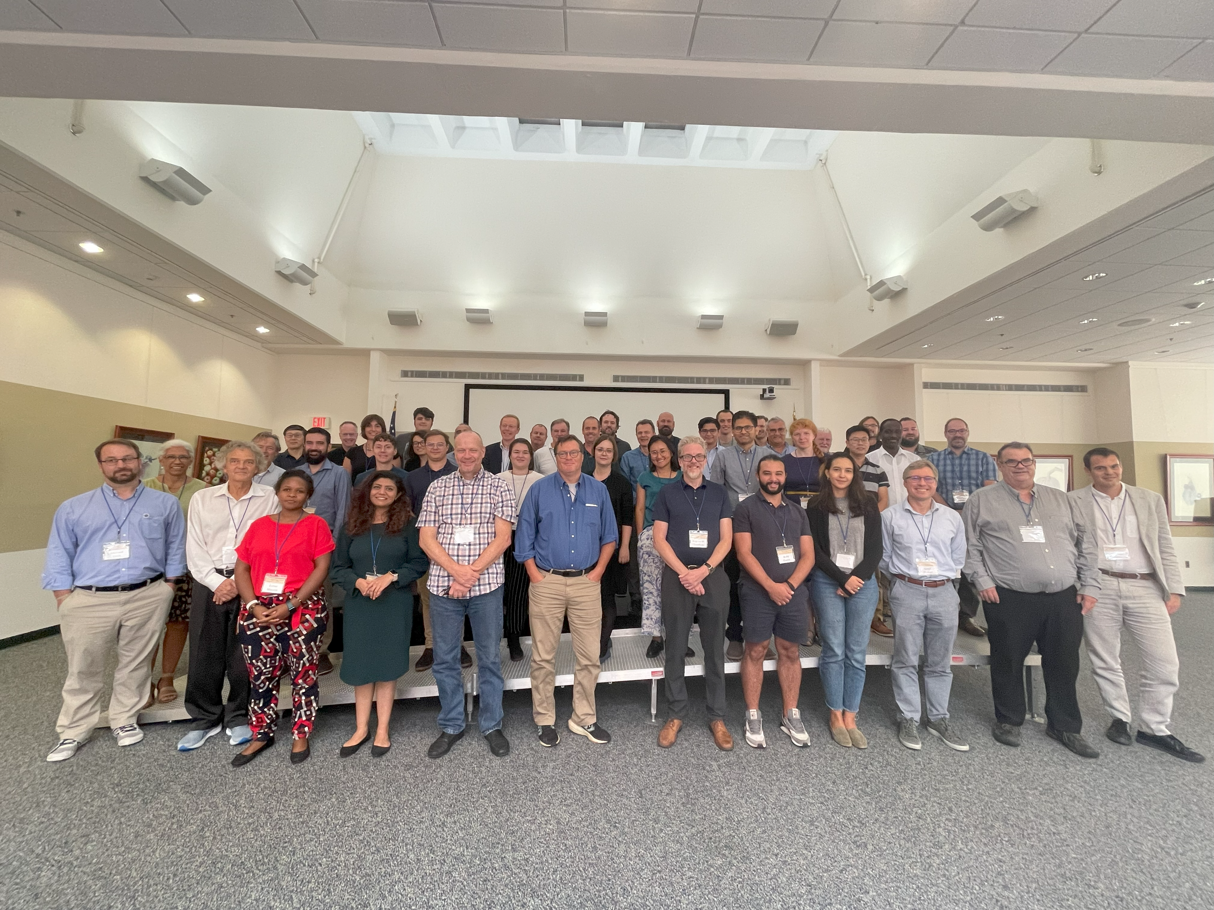
In a collaborative effort to enhance the accuracy and consistency of cropland and crop type mapping, the International Geo-Innovation Center hosted the Joint Workshop in Beltsville, Maryland, spanning from Sept. 12 to 14. This event was co-organized by the Committee on Earth Observation Satellites Working Group on Calibration and Validation Land Product Validation subgroup with a focus on Land Cover (CEOS LPV Land Cover) and the Group on Earth Observations Global Agricultural Monitoring Initiative Essential Agricultural Variables Working Group (GEOGLAM EAV), gathering experts from the fields of cropland and crop type mapping, and map validation.
The workshop, ran by Associate Research Professor Alexandra Tyukavina, Associate Research Professor Alyssa Whitcraft and Distinguished University Professor Chris Justice, with the coordination of Assistant Research Professor Varada Shevade on behalf of the International Geo-Innovation Center, pursued a set of paramount objectives. These goals encompassed the formulation of community guidelines and resources designed to facilitate accuracy assessment specifically for cropland and crop type mapping. Moreover, the workshop strived to foster the development of consistent comparable, multi-scalar essential agricultural variables (EAVs), ultimately intending to present these guidelines as a peer-reviewed journal article.
Several Geographical Sciences faculty participated in the workshop, leveraging their expertise in the fields of cropland and crop type mapping, as well as map validation methodologies. Among them were Professor Matt Hansen and Associate Professor Sergii Skakun, who delivered keynote presentations on their approaches to cropland mapping and validation at continental and national / subnational scales, while Assistant Professor Xiaopeng Song presented on the topic of sampling design. Research faculty Michael Humber and Anna Komarova, as well as faculty specialists Jeffrey Pickering and Bernard Adusei, and graduate students Christian Abys, Meghavi Prashnani, Sheila Baber, Haijun Li, Sasha Mikus, Walid Ouaret and Leonid Shumilo also participated in the workshop.
Tyukavina and Whitcraft were instrumental in securing funding for this workshop, with support provided by NASA.
Main image: Representatives from UMD, VITO, UCLouvain, NASA, USDA, USGS, State University of New York, European Commission – JRC, IGN FI, WRI, Agriculture and Agri Foods Canada, University of Hong Kong, Wageningen University, Impact Observatory, ESA / ESRIN, UNFAO, IIASA, GEOGLAM Secretariat, EFTAS, EPA and the University of Michigan pose for a group photo at the National Agricultural Library, Beltsville, MD. Courtesy of Varada Shevade.
Delegation from Egypt’s Ministry of Agriculture and Land Reclamation Explores Cooperation
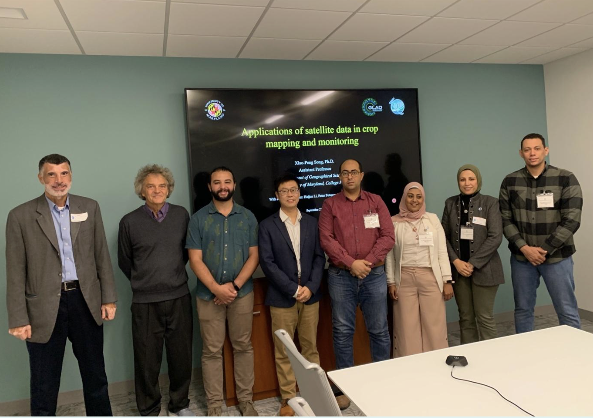
Professor Chris Justice, Assistant Professor Xiaopeng Song
and graduate students Walid Ouaret and Sheila Baber.
Photo courtesy of Chris Justice.
On Sept. 27, a delegation from the Egyptian Ministry of Agriculture and Land Reclamation, Agricultural Research Center, and the Climate Change Information Center visited River Road to meet with Distinguished University Professor Chris Justice, Assistant Professor Xiaopeng Song and graduate students Walid Ouaret and Sheila Baber and exchange information on the NASA Harvest, Global Land Analysis and Discovery (GLAD) and the NASA Acres Programs .
Song presented an array of research findings, spanning from GLAD's profound insights into Landsat global cropland change to the innovative use of Planet data for monitoring Chinese agriculture. The implications of civil conflict on Syrian agriculture were also explored, offering a multi-faceted perspective on the challenges that the agricultural sector faces globally.
Justice discussed the work of GEO Global Agricultural Monitoring (GEOGLAM), NASA Harvest, NASA Acres and the international GOFC-GOLD Regional Networks, showcasing how international collaboration and data sharing can propel the agricultural sector forward.
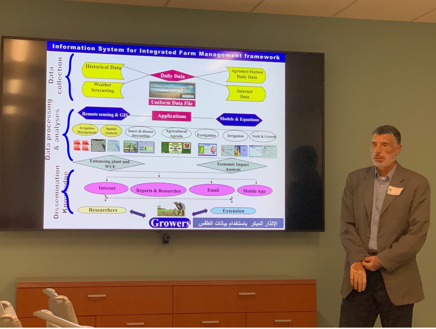
extreme events on Egyptian agriculture.
Photo courtesy of Chris Justice.
Dr. Alaa Khali, professor of agrometeorology and supervisor of the Early Warning Unit at the Climate Change Information Center and Renewable Energy (CCICREES) provided insights into the impact of extreme events and climate change on Egyptian agriculture.
Egypt has experienced the hottest 10 years on record since 1991. Dr. Khali documented the impacts of heatwaves, cold waves and flooding, most recently from tropical storm Daniel on agricultural production. He presented results from a study indicating that a 50-centimeter sea level rise would submerge 1,800 km of land and affect 4 million people. Additionally, he discussed the impacts of saltwater intrusion and outlined adaptation strategies in the context of the National Adaptation Plan.
The delegates described the current capability of the national Early Warning Unit and their Information System for Integrated Farm Management. They expressed an interest to increase the use of Earth observation and explore tools and datasets available from Geographical Sciences. Areas of interest for collaboration included crop condition monitoring, crop type mapping, crop production forecasting, insect infestations, irrigation management, and farmers advisory.