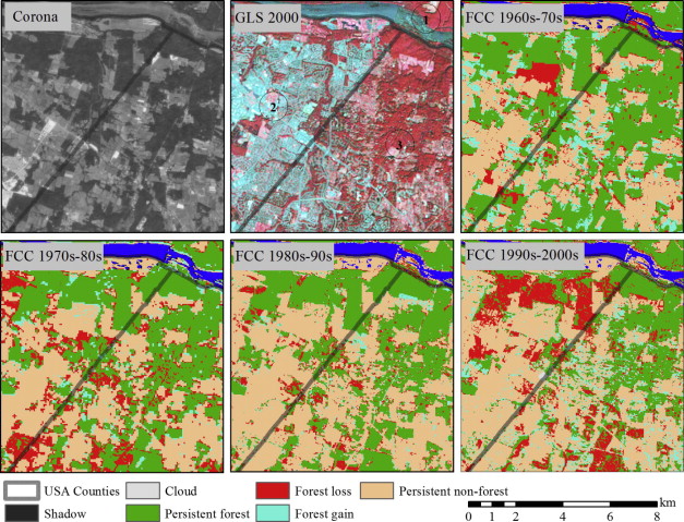
Ph.D student Danxia Song, Dr. Chengquan Huang, Dr. Joseph Sexton, Saurabh Channan, Dr. Min Feng and Dr. John Townshend published a paper entitled, “Use of Landsat and Corona data for mapping forest cover change from the mid-1960s to 2000s: Case studies from the Eastern United States and Central Brazil,” in the Journal of ISPRS Journal of Photogrammetry and Remote Sensing.
This study demonstrated the feasibility and techniques of applying the declassified satellite, Corona, images in mapping historical forest cover and change, extending the temporal coverage of Landsat image backward to 1960s. Using both Corona and Landsat images, it is observed that study regions in the eastern U.S. (urban) and central Brazil (tropical forest) has different forest cover change trajectories during 1960s and 2000s. “The average annual forest loss rate in the urban area doubled from 0.68% to 1.9% from the 1960s to the mid-1980s and then decreased during the following decade. In contrast, deforestation in the Brazilian study area continued at a slightly increased pace between the 1960s and 1990s at annual loss rate of 0.62–0.79% and quickly slowed down afterward.” This paper ended with suggesting increased utility of Corona image for retrieving a wide range of land cover histories around the world, accompanied with potential solutions for the technique challenges.
Journal URL: http://www.sciencedirect.com/science/article/pii/S0924271614002305


