When senior Marcus Johnson graduates with a Geographical Information Systems (GIS) major and a minor in remote sensing, he will have an impressive NASA internship under his belt.
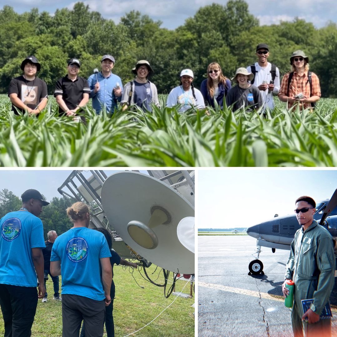
Through NASA’s Student Airborne Research Program (SARP), Marcus acquired hands-on research experience that only solidified his passion for geographical information systems: He got to fly on a research aircraft to collect data on greenhouse gases and help operate a truck equipped with a ground penetrating radar.
GEOG spoke with Marcus to learn more about the summer internship, the remote sensing minor and his tips for GIS students.
What has been the most memorable part of your internship?
If I had to choose one, it would be my flight on the research aircraft Dynamic Aviation B200—“the "Sniffer," as we call it in the program. I had the pleasure of flying alongside the director of the NASA Earth Science Division, Dr. Karen St. Germain. We collected a variety of measurements in the atmosphere focusing on concentrations of aerosols and particle sizes. We also measured concentrations of nitrogen dioxide (NO2), carbon dioxide (CO2), formaldehyde (CH2O) and greenhouse gases. The program is striving to provide research that will help further our understanding of the complex science of Earth systems and how these gases have affected the Chesapeake Bay.
Can you tell us about the instruments you used to conduct research?
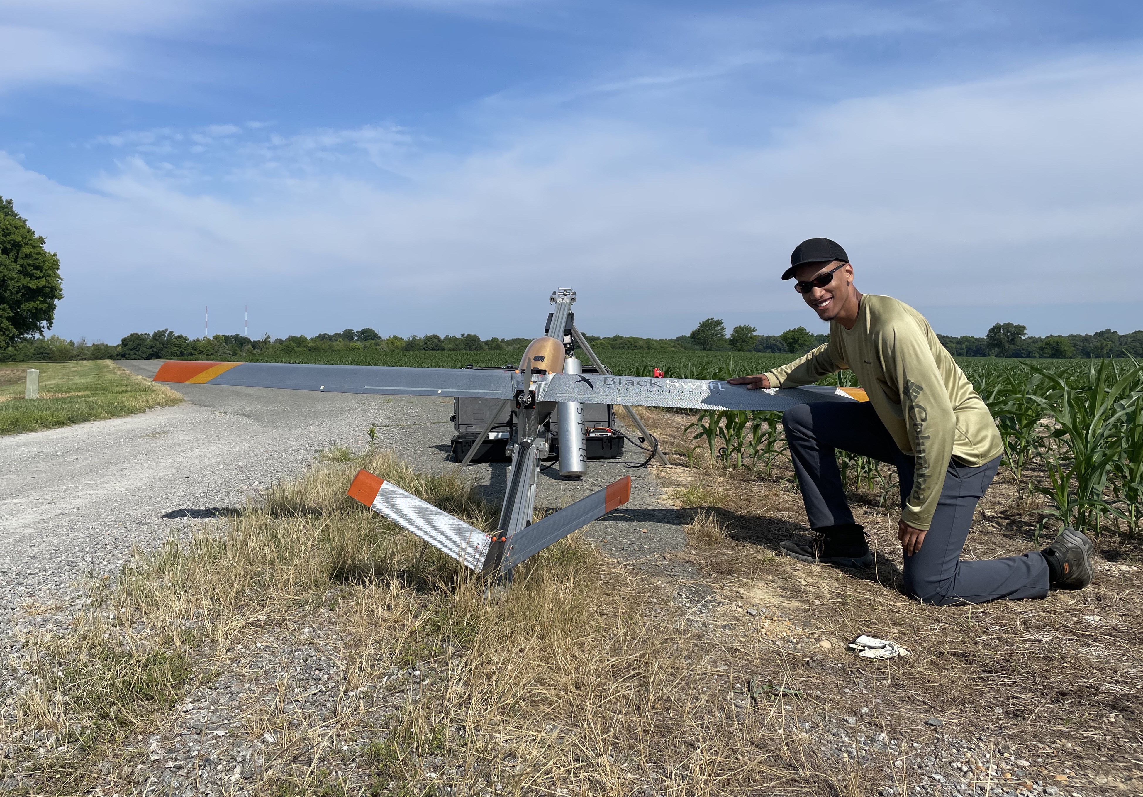
We used a drone called the Blackswift S2, which has a passive L-band radiometer to help detect surface temperature and a multi-spectral camera called MicaSense to detect visible and infrared wavelengths, read the thermal profiles of the land surface, and measure the health of the vegetation in the land.
The team also used a Combined Radar/Radiometer (ComRAD) mounted on a truck and equipped with a multi-spectral radiometer that could capture data in visible and infrared wavelengths, and a radar that penetrates the ground and measured soil moisture.
There was a Scanning L-Band Active Passive (SLAP) that was attached to research aircraft Beechcraft Super King Air B200. Its primary application was to sense soil moisture in a freeze/thaw state and to sense the salinity of seawater.
We also used Theta Probe ML2"sensors, Theta Probe ML3 sensors and HH2 Data Loggers to capture soil moisture data. The sensors send out an electric charge to detect the amount of moisture in the soil by finding the dielectric constant or the conductivity of water.
These instruments allowed us to collect and compare data from the ground to the air or, as we say in the program, "Point to Pixel to Planet."
"I was fortunate enough to be minoring in remote sensing and being able to follow along with the program smoothly."
Marcus Johnson, GEOG student
How has this experience shaped your perspective on remote sensing and GIS?
This experience has allowed me to use GIS and remote sensing outside of a classroom setting. It has given me a chance to test my skills and experience how both fields are used in a research campaign. Going out into the field and experiencing the work first-hand is just as important as the classroom. This program has given me a greater appreciation of the GIS and remote sensing fields and a better understanding of how they are used in the Earth sciences.
The internship has solidified my passion for GIS. The type of job that I would like to have after graduation would be similar to what I am doing now. I have enjoyed traveling to the research site, conducting fieldwork and coming back to the office to analyze the data.
When I start working, I want to be moving around and not be sitting in an office the entire time. This experience has shown me that not only is it possible to have a job like that, but it has also given me a path to achieve it.
How has the remote sensing minor helped you prepare for the internship?
Interns who have not taken remote sensing courses may find the projects a little more challenging because they will be forced to acquire remote sensing knowledge in real time. In other words, they will be learning related coursework topics while they are simultaneously completing critical project milestones. This duality of learning and working with project deadlines hanging over your head may be frustrating and time consuming for some interns. I was fortunate enough to be minoring in remote sensing and being able to follow along with the program smoothly.
What’s a piece of advice you’d give to students interested in remote sensing and GIS?
Apply for internships! I know it sounds cliché, but it is true. The classroom will give you the building blocks you need to get into the field, but it is up to you to decide what you want to build with the tools you have. Apply to as many internships as you can and do not be afraid to apply somewhere where it seems like you are underqualified because you never know.
Main image: Marcus Johnson poses next to a Blackswift S2 drone. Photos courtesy of Marcus.
This interview was edited for length and clarity.