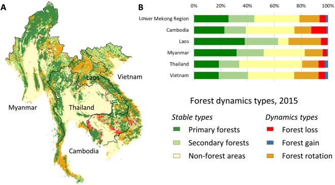
The methodology behind regionally consistent annual continuous fields of woody vegetation structure in the Lower Mekong has been published in Remote Sensing of Environment by a team of co-authors from UMD GLAD, SERVIR-Mekong/Asian Disease Preparedness Center (Thailand), University of San Francisco and Spatial Informatics Group, led by GEOG Research Professor Peter Potapov.
Spatially and temporally consistent vegetation structure time-series have great potential to improve the capacity for national land cover monitoring, to reduce latency and cost of international reporting, and to harmonize regional land cover characterizations. Here we present a semi-automatic, operational algorithm for mapping and monitoring of woody vegetation canopy cover and height at a regional scale using freely available Landsat time-series data. The presented algorithm employs automatic data processing and mapping using a set of lidar-based vegetation structure prediction models. Changes in vegetation cover are detected separately and integrated into the structure time-series. Sample-based validation and inter-comparison with existing datasets demonstrates the spatial and temporal consistency of our regional data time-series. The algorithm was prototyped within the Lower Mekong region where it revealed an intensive woody vegetation dynamic. The time-series product is suitable for mapping annual land cover and inter-annual land cover change using customized class definitions. The regionally-consistent data are publicly available for download (https://glad.umd.edu/), and online analysis (https://rlcms-servir.adpc.net/en/forest-monitor/), and serve as an input to the SERVIR-Mekong Regional Land Cover Monitoring System.


