USAID's blog LandLinks features the work of Assistant Professor Catherine Nakalembe with Kenya’s Ministry of Agriculture using satellite data to help farmers.
At Kenya’s Ministry of Agriculture, Head of Food Crops Statistics Ms. Jane Kioko takes on the enormous task of compiling monthly crop data for the country. Small-scale farmers make up 75% of the nation’s agricultural output. As our climate changes, these farmers navigate more extreme challenges, like droughts and crop diseases. Through a collaboration between USAID and NASA, decision-makers like Kioko can use the birds-eye view of satellite tools to expand their understanding of the challenges that farmers are facing.
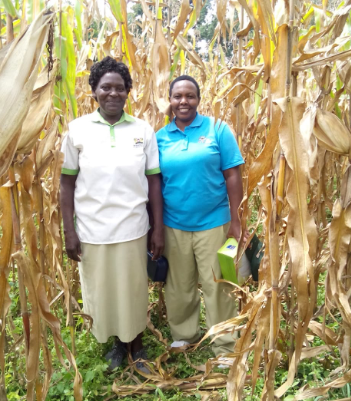
Kioko and her colleagues are connected to farmers through a broad network of county agricultural extension officers. These officers meet with farmers directly to provide resources and technical information, and report on farm conditions to inform national decision-making.
This approach to gathering information can be time-consuming. Often, less than a third of the needed data made it back to Ministry staff like Kioko. To know when to distribute support, such as insurance payouts after a drought, Kioko needs to access highly localized data, like rainfall and field-level crop yield estimates.
Enter Dr. Catherine Nakalembe, an Applied Sciences Team Principal Investigator for SERVIR. Nakalembe is an award-winning Assistant Professor at the University of Maryland and the Africa Director for NASA Harvest. Since 2016, Nakalembe has collaborated with Ministry staff in using satellite data to predict areas at risk for food shortages.
SERVIR is a collaboration of NASA and the U.S. Agency for International Development (USAID), partnering with organizations around the world to support locally led climate efforts with Earth data.
With SERVIR, Nakalembe helps to create country-specific versions of the regional Crop Monitors tool established through the Group on Earth Observation’s Global Agricultural Monitoring Initiative (GEOGLAM). Crop Monitors uses satellite data to capture a more expansive view of agricultural conditions. Nakalembe partners with agricultural ministries to combine satellite data with on-the-ground information to paint a clearer picture of where food security support is needed. Regional demand for improved crop monitoring is so high that the project now spans six countries: Kenya, Malawi, Rwanda, Tanzania, Uganda, and Zambia.
Main mage: Jane Kioko (left) meets with farmers to compile data. Photo courtesy of Catherine Nakalembe.