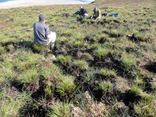
The proposed project will focus on investigating and quantifying fire-induced changes in Alaskan tundra with a specific aim to assess the region’s vulnerability to on-going and future environmental change and the changes to carbon cycling in this ecosystem. In particular we aim to address several specific ABoVE-identified research priority areas including: 1) What processes are contributing to changes in disturbance regimes and what are the impacts of these changes? 2) What processes are controlling changes in the distribution and properties of permafrost and what are the impacts of these changes? and 3) What are the causes and consequences of changes in the hydrologic system, specifically the amount, temporal distribution, and discharge of surface and subsurface water? While quite rare in Canada and Northern Eurasia, wildfire is a major disturbance agent in the tundra ecosystems of Alaska. Existing paleo records, fire management records, and satellite observations have shown that wildfire has been a prevalent and recurring disturbance agent across many tundra ecoregions of Alaska and constitutes an emerging threat in previously less impacted tundra zone of North Slope. With the apparent changes in climate of the region expressed in prolonged growing season, shrub encroachment, and increasing temperature affecting both fire weather and above ground biomass and subsequently fire fuels, there is a considerable potential for a substantial change in fire regimes within this region which is likely to lead to notable changes in carbon stocks and ecosystem functioning. Our previous results indicate that immediately after burning fire-impacted areas are characterized by small but statistically significant differences in active layer depth, soil moisture levels, and soil temperature compared to the adjacent unburned areas. Other previous studies have shown persistence or an increase in differences in active layer depth and soil moisture over a 3-5 year period after the fire event. However, at present very little is known about these impacts outside of a single extreme recent fire event or about the differences in ecosystem functioning in unburned (within the past 65 years), single-time burned and repeatedly burned areas and the extent to which burned area is susceptible to repeat burning. Within this project we propose to collect field measurements of fire impacts on tundra ecosystems to characterize variation in 1) active layer depth, 2) soil moisture, 3) soil temperature, 4) vegetative cover, and 5) soil organic layer thickness across a wide range of burn scars of different ages and characteristics and adjacent unburned areas. These measurements will deliver a comprehensive dataset that will support quantification of above and below ground carbon stocks, permafrost mapping, surface hydrology characterization, and susceptibility to future fire occurrence through changes to fuel loading and site conditions. We propose to conduct 3 intensive field campaigns in tundra ecoregions characterized by different fire regimes including: 1) the Noatak River valley (Brooks Ridge), 2) Seward Peninsula, and 3) foothills of the North Slope of Alaska. We propose development and statistical testing of a wide range of satellite-based metrics to establish and quantify the relationships and produce wall-to-wall maps for several ecosystem characteristics for each ecoregion through Random Forest modeling.