John Doroba, a Fall 2021 graduate of the MS GIS program and a physical scientist at the National Oceanic and Atmospheric Administration's (NOAA) Hydrographic Systems and Technology Branch (HSTB), has published the results of his capstone project in the Winter 2022 issue of ArcUser.
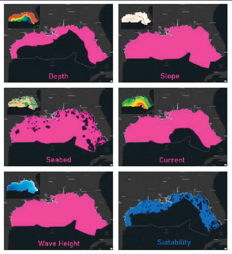
John's capstone, "Suitability Analysis of NOAA GNSS Tide Buoy Locations in the U.S. Exclusive Economic Zone Using ArcPy and GeoPandas Python Scripts for Custom Arc Toolboxes," produced a custom Python tool for ArcGIS to allow users to easily identify suitable anchorage locations for NOAA Global Navigation Satellite System (GNSS) tide buoys. The tool, which uses the ArcPy and GeoPandas Python packages, will be valuable as a cost-effective method to assist NOAA scientists in the ideal placement of GNSS tide buoys.
Learn more about our Fall 2021 MS program capstone projects.